
Gaddings Dam was built as a mill pond in about 1833, when the Industrial Revolution positioned West Yorkshire and the north of England as the centre of the developed world’s cotton-spinning and weaving mills. It sits above the market town of Todmorden, out of sight on the moor of Langfield Common, with a sandy beach that claims to be the highest in England.
The Gaddings Dam Preservation Company bought the deeds to the reservoir in 2001 for £1,500, on the condition that it was preserved for the people of Todmorden. These days, with restricted access to water in lakes and reservoirs, Gaddings has become a much-valued and popular local swimming spot.
It is wild, nearly always windy and, as one of the regular dippers calls it, “a wild swimmer’s paradise”.
We have just finished production of a feature documentary, Wild Water, about the local community who use the dam, particularly the swimmers who dip all year round. So we embarked on the 9km circular walk of Stoodley Pike to take in the glorious views and industrial heritage – and enjoy a cold water plunge.
Gaddings Dam is accessed by a range of walking routes, the most direct of which is a 20-minute hike up an eroded steep path. At its start, opposite the Shepherd’s Rest pub, we meet up with some of the main characters from the film.
There is Clive, who reckons he takes 500 to 600 dips a year and can often be found playing his banjo on the shoreline; Jamima and Donna, who swim most days, but every week as part of the Saturday Morning Crew; and Vicky, who has to steel herself to climb what she lovingly refers to as “the hateful hill”.
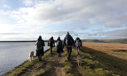
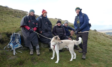
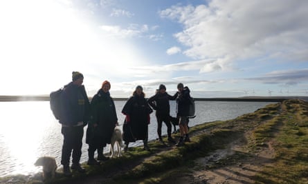
The sun is making a rare appearance in one of the wettest corners of the country. Recently, we were told that there haven’t been more than two days without rain in the past six months, which, true or not, seems believable. The chat on the way up is of wind direction, the weather (of course), and the water temperature, which is estimated at 5C. After 15 minutes, we stop at Vicky’s regular spot to have a breather and take in the views. The Calder Valley shimmers with moorland, fields, lakes and pockets of houses as wind turbines gently turn in the distance.
Energy restored, we head for the summit, and as we hit the top of the steps, the glory of the dam reveals itself, along with the wind. The body of water never fails to look anything less than spectacular: rugged, windy, industrial … and inviting. Rather than heading to the beach, we go to the regular swimmers’ spot on the wall, which is more sheltered and means a quicker entry into the water thanks to the sheer drop-off, with the added bonus of no sand.
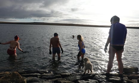
It takes about three steps into the clear, dark waters to submerge up to your shoulders, bringing an all-over body sensation that automatically triggers your mind to swim; it’s truly invigorating. Everyone shouts, laughs and cajoles each other before the breath steadies and the mind clears. It’s a handful of minutes before we’re walking back up the stone bank, goose bumps rising with the wind and skin fizzing with adrenaline. Towelled off and keen to get warm, we bid farewell to our fellow swimmers and set off to the eastern corner of the dam to pick up the Pennine Way.
Single flags mark the way, and two grouse bomb past, probably making a run from one of the local shoots. The moor’s peat bogs are a significant carbon sink, and in parts, if you jump up and down, you can feel them move and wobble. We stop as we reach some poles with a Crows (Community Rights of Way Service) sign telling us the path has sunk into the black, soggy peat and we must find another way through.
-
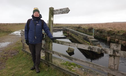
What looks like a Victorian bath, built in the middle of nowhere, is actually a de-silting chamber and settling tank for the Warland reservoir
We pick our way around to a fine example of the area’s industrial heritage. What looks like a Victorian bath, built in the middle of nowhere, is actually a de-silting chamber and settling tank for the Warland reservoir. Its use has long since passed, but it is still a wonderful example of Victorian engineering.
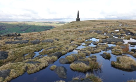
Onwards to Stoodley Pike, topped with its 37-metre obelisk, built in the 19th century. Its barely visible engraving describes it as a “peace monument erected by public subscription commenced in 1814 to commemorate the surrender of Paris to the allies” (in the Napoleonic wars). Thankfully, there’s a sheltered ledge where we stop to eat our lunch, watched by a pair of hungry and optimistic dogs. Setting off from the monument, we greet a barefoot runner on their way across the moor, demonstrating the human appetite for a direct connection with nature and the environment, and echoing the ethos of those who enjoy “skin” swimming in Gaddings Dam.
As we descend towards the picturesque hamlet of Mankinholes, the glories of the valley unfurl, before we lose the spectacular views on reaching the Old Coach Road. According to local Eric Spofforth, a retired mountain rescue dog handler, the path was built by local MP John Fielden during the cotton famine of the early 1860s to keep his men in work and out of mischief.
We skirt the bottom of the moor before cutting through Mankinholes and past the Top Brink Inn. Resisting the urge for a pint, we drop down to Lumbutts water tower, which has something of the Brothers Grimm about it and was restored in 2017 thanks to a crowdfunding campaign. It once had three huge water wheels one above the other, each 30ft in diameter and 6ft wide, to power Lumbutts Mill, which is now home to an activity centre.
Then we hit the road for about a third of a mile back to the starting point for a well-earned pie and a pint of Yorkshire’s finest at the Shepherd’s Rest.
Wild Water will be released in the UK in 2024


