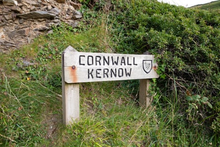
A few minutes into a “guided” walk along the new Tamara Coast to Coast Way, which roughly traces the border of Cornwall and Devon, my guide is looking sheepish. We’re standing in a grassy field flanked by overgrown hedgerows and with no discernible exit. I was promised a panoramic view of the Tamar river stretching off into the distance.
“Are we lost?” I inquire mischievously. “Give me one moment,” comes the reply. “I walked this route in the opposite direction last time!”
-
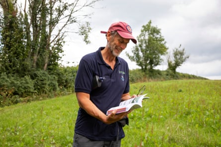
Will Darwall, manager of the Tamara Landscape Partnership Scheme, a partnership of 21 organisations – including Cornwall Council, Devon County Council, the National Trust and Historic England – which aims to promote the Tamar valley and its communities
-
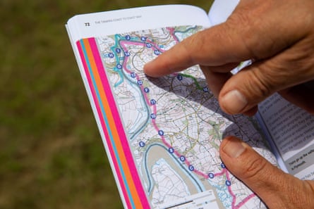
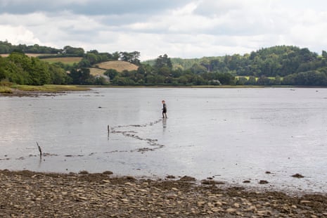
Darwall points to the guidebook, showing our direction of travel. Eventually, we find the view of the Tamar river which we’ve been looking for
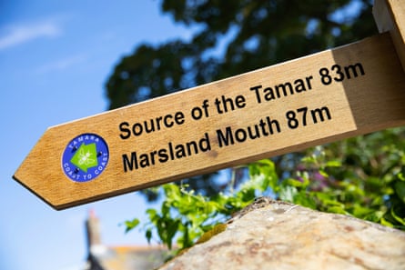
My guide is Will Darwall, manager of the Tamara Landscape Partnership Scheme (TLPS), the organisation that has created the 87-mile walk running from Cremyll near Plymouth in the south to Marsland Mouth, near Bude in the north. Officially opened this month and supported by £2.3m from the National Lottery Heritage Fund, it joins two popular routes – the Tamar Valley Discovery Trail and the Bude Canal Trail – with existing public footpaths and a new permissive path near St Mellion, allowing people to safely walk a signposted route from coast to coast for the first time.
“People ordinarily go to the coast or Dartmoor or Bodmin Moor, and they drive straight past the Tamar Valley,” says Darwall. “We consider this the forgotten gem of the region. Some of the nicest walks I’ve ever been on are here.”
Thankfully, there’s a handy guidebook with directions. Darwall consults his, points assuredly to the other end of the field and we are soon back on track.
Muddy and majestic
-
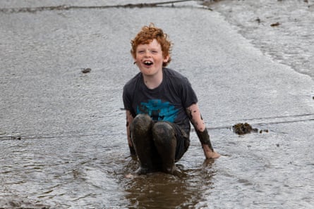
Xavier, 10, who we met prior to our walk, playing in the mudflats near Bere Ferrers at low tide
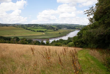
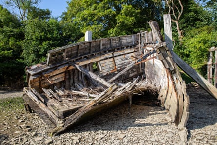
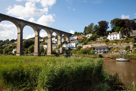
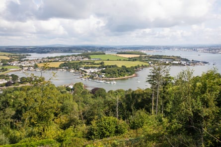
We’re walking a short portion of stage three – if you can call three miles of undulating terrain “short” – from a tiny bay at Hole’s Hole that’s strewn with the ruins of an old yacht, towards the majestic Edwardian viaduct at Calstock.
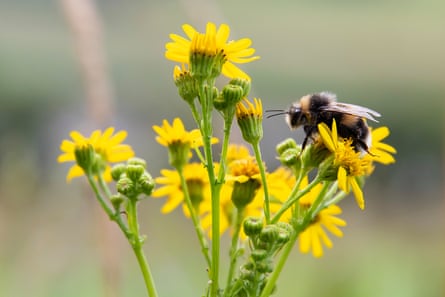
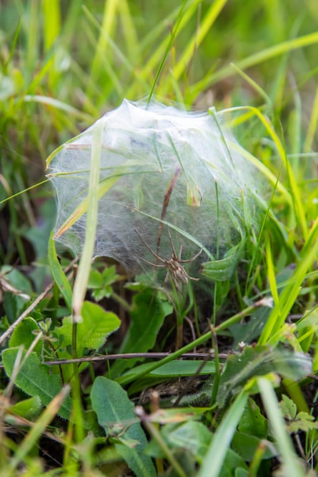
Hills rise and valleys fall steeply beneath our feet, while the Tamar’s mudflats are slowly swallowed by the rising tide. Around us, nature is thrumming. Bees and butterflies skitter from flower to flower, while vivid blooms and thistles sprout wherever the sun shines.
Darwall says: “There’s been phenomenal interest from people wanting to buy the guidebook and we’ve had overwhelming support from locals. Our aim is to encourage more people to come here. Hopefully visitors will use the cafes and the B&Bs en route.”
Almost three hours after we set off – and having still not passed another walker – Calstock viaduct finally comes into view. The majestic Grade II*-listed structure, built between 1904 and 1907 by John Lang, stands 37 metres (120ft) high and has 12 symmetrical arches. Calstock train station lies tantalisingly close on the opposite side of the river, but walking over the viaduct is illegal and TLPS’s plan to reinstate a local ferry crossing is still being negotiated.
The only way back to our cars is to keep walking. That is until Darwall charms a local farmer who generously gives us a lift in his ute. “I won’t be doing this for everyone,” the farmer quips.
Walkies with Ted
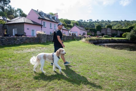
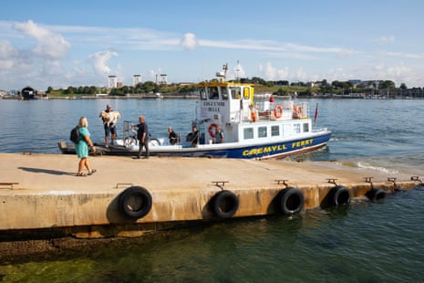
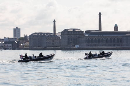
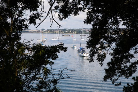
The coast-to-coast walk officially begins at Cremyll, where a wooden fingerpost warns prospective hikers of the long journey ahead. I stall my departure to admire the view across Plymouth sound. The scene reminds me of living in Sydney, Australia: a super yacht, a tiny fishing boat, two Royal Navy RIBs and a tug boat all cruise past, while Royal William Yard looks resplendent in the distance. The Cremyll ferry soon pulls up and a man disembarks with a large dog in his arms.
“I was super excited when I heard about the new walk,” says Phil Rendell, as Ted the labradoodle saunters down the trail. “My dad loves walking and following the coast paths, and now we have a new route to walk, so he’s all pumped up and wants to come back over from America, where he lives, to walk a few sections with me. Maybe we can make it all the way to Bude one day if we break it up into small stages.”
We reach a property with a castle-style wall draped in ivy, formerly the kitchen garden for nearby Mount Edgcumbe estate. A local resident politely informs us we’ve strayed slightly from the path and are now walking through his front garden. “You’re not the first”, he says.
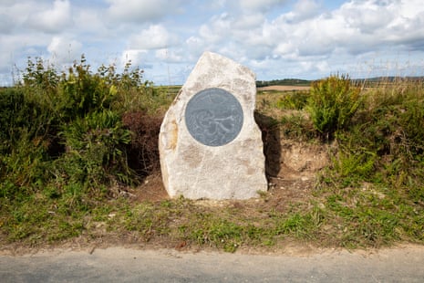
Tracing the source
The following day I head north by car, shamelessly skipping most of the walk to arrive at the source of the Tamar. I’ve missed many captivating views and historic sites, among them the stepping stones of Lopwell Dam, St Mellion church, Launceston Castle and Horse Bridge – the oldest surviving bridge across the Tamar, which dates from 1437 – but it feels apt to visit the source of this mighty watercourse. The spot is marked by a giant boulder on the side of a quiet country lane.
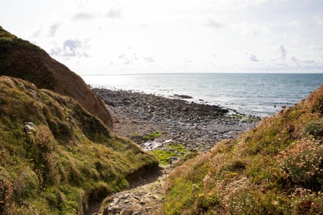
I amble down to Marsland Mouth, emerging on to a rugged coastal path where the Atlantic Ocean finally heaves into view. A bracing onshore wind whips through the long grass and races up the valley.
A solitary walker passes me and I tell him I’m surprised by how few walkers I’ve seen. “When the sun’s out I just seem to get drawn outside,” says Nicholas Childs. “It’s really dramatic scenery around here but it’s not always this quiet.”
My journey ends as I cross a wooden bridge which links Devon and Cornwall, metres from the shingle beach. Now I just need a farmer with a ute to help me get home again.